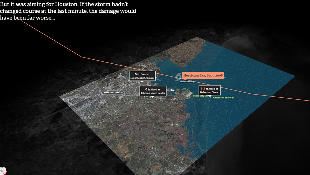
Investigative journalism nonprofit ProPublica and the Texas Tribune have created “Hell and High Water,” a series of data visualizations illustrating the potential devastation a powerful hurricane could cause to the Houston Ship Channel, one of the world’s busiest shipping lanes. Because so much industrial activity relies on the Houston Ship Channel, which is also home to the largest petrochemical complex in the United States, such a storm would be particularly damaging to the national economy. The purpose of the visualization is to demonstrate how three mitigation efforts would help Houston better prepare for the inevitable storm. The visualizations use data from the U.S. Census, satellite imagery from the U.S. Geological Survey’s Landsat program, and a variety of other data sets from government agencies and research institutions to simulate the damage.
Visualizing the Damage of a Superstorm in Houston